A Digital Connectivity Map for London, but government needs to address data problems…
Today the GLA’s Connected London Map goes live, giving a better (but not live, nor complete) overview of digital connectivity in London. The Map is part of the work of the Mayor’s new Connected London team, set up in 2017 to provide a step-change in London’s approach to boosting fibre provision and tackle areas of poor connectivity.
This post sets out what the new tool does, and some of the deficiencies in the UK’s data-gathering in this important area.
What the Map does
The Map uses Ofcom Connected Nations postcode data to display coverage by borough, ward, postcode, and London wide. It provides instant analysis of percentage of properties, and includes the ability to export data to support boroughs and others in addressing their connectivity ambitions.
It looks at availability of Full Fibre (FTTP), Ultrafast, and Superfast (FTTC) connectivity.

It also shows areas of unavailability, where properties can’t access speeds of 30mbit/s, 10mbit/s, 5mbit/s, and 2mbit/s.

Our Map will be updated whenever new data are published. The next phase of will include the ability to compare historical coverage and export reports.
It is the most comprehensive information publicly available. However, it is subject to a number of important caveats that we feel need to be addressed by DCMS and Ofcom.
What does the Map show?
It demonstrates that coverage of Superfast in London is currently at 95.6% of properties, which means the Department for Digital Culture Media and Sport (DCMS) target of 93% by 2017 was just in London, and the next target of 97% by 2020 is also unlikely to be met (the map shows it at 95.6%).
We are also seeing Full Fibre coverage sitting around 11.5%, and being contained within small pockets of the city. The DCMS target within the Future Telecoms Infrastructure Review aims for 15 million premises across the UK connected with full fibre by 2025, around 50%.
To achieve this target we need to see significant levels of private investment, and for it to be directed right across London, not just in the commercially viable areas or we risk seeing the same problem with FTTP that we have seen with FTTC: where some areas are left chronically under-served.
With this tool we provide greater transparency for those who want to understand what connectivity looks like across London. Councils can have a clearer picture on what digital provision looks like in their area to inform their digital strategies and ambitions, and enable them to plan for how they can help to use their assets and the tools available to them to encourage and direct investment in under-served areas.
Data — Government & Ofcom needs a new approach
The Connected London Map only provides a view of estimated coverage.
There are a number of factors that prevent us providing a better picture of exact availability.
First, the dataset is based on self-reported coverage information rather than actual infrastructure locations. The current system incentivises providers to over-report availability, because Connected Nations reports are only published annually, with two extra updates per year. We suspect predictions of planned investment may also be also gamed, to disincentivise investment in areas by potential competitors.
We have already seen areas being reported as having Full Fibre coverage where we know this is not yet available. Ofcom could consider publishing this data more regularly to limit over-reporting.
We have evidence to suggest that not all providers are captured in this process, leading to some under-reporting.
Second, the collection methodology also builds in over-reporting through lack of granularity. If one property in a postcode has availability of a particular service, than the whole postcode is considered to have coverage in the dataset. This again limits the accuracy of the map and paints a market as competitive when it may not be so. As well as the potential for overestimating coverage, being based on postcodes rather than on an individual property’s availability also limits the accuracy to only providing a representation of coverage rather than accurate coverage. According to Ofcom this is apparently done for confidentiality reasons.
Thirdly, there’s transparency. Ofcom have not identified what methods they use to audit the accuracy of this data. They need to take greater charge holding providers to account over their reporting of availability and consider methodologies that would provide more accurate representations of availability.
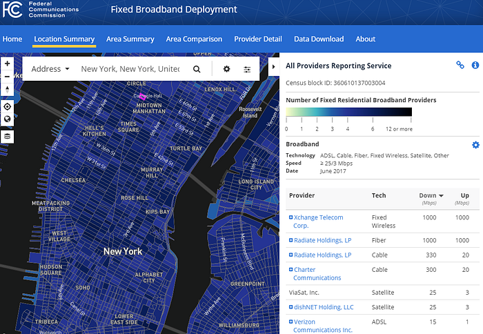
The dataset also does not provide any transparency over the number of providers serving an area and the technologies they deliver services on. This is some the Federal Communications Commission does in the US, an example here.
We’d strongly encourage Ofcom to adopt a similar approach for reporting availability from a variety of providers. This would seek to encourage competition and may incentivise more accurate reporting if an individual provider is held accountable for their representation of availability.
Finally, there isn’t an API for this dataset, so the map must be manually updated whenever an update to the dataset is published. This is a small change that would allow us to make better use of the data.
Next steps
So while our Map gives greater transparency to London’s policymakers than before, there are clear challenges with data at a national level which need to be addressed.
This has consequences for Londoners.
Most obviously it means we lack true granularity on areas with low, or no speeds. Despite new services on the market, e.g. Wiredscore, can the citizen, business or council seeking to enhance connectivity truly know ‘what good looks like’ from existing data sources?
Relying on data with in-built over-reporting gives a rosier picture of London’s position than may be the case. Government funding decisions to support London through market-stimulation, for example, appear to rely exclusively on this data. There is a risk that national funding decisions are influenced by this.
Finally, we need to resolve the inherent tension between provision of information in order to inform public policy in a competitive market.
Something is better than nothing, but a rethink is needed if digital connectivity is truly to be considered the ‘fourth utility’ government now considers it to be — an everyday necessity alongside water, gas and electricity.
